Monday, September 19, 2011

Doing Dordogne - Day 8

Tuesday, September 13th
      We enjoyed a leisurely breakfast this morning. Just a little way up the street I found a tabac that offered cafe-creme and a croissant. Jane went across the street to a patisserie to get a croissant and a small orange juice, then joined me on the terrace in the bright sunshine that had rapidly dissipated the early morning fog.
      We set off up the very steep cobbled lane that we had followed on Sunday, stopping several times to rest and marvel at the vistas across the Dordogne Valley. We finally approached the Chateau de Beynac, and bought admission tickets.
      As we wandered past walls within walls and gates beyond gates, and crossed a drawbridge over a 20 foot deep pit whose bottom was covered with sharpened wooden spikes we were impressed with the attention to security.  
        As early as the 16th century they even had the capability of conducting chemical warfare. Above two inner gates there were protected wooden extensions out from the stone walls to allow defenders to dump buckets of caustic lye on attackers trying to breach the inner defenses..

     The oldest part of the fortress was the castle keep, a five story tall tower. Whoever was occupying the chateau could retreat here behind all the layers of defense, and pull up the ladders through a narrow trap door, making it very difficult to reach. The English King Richard the Lionheart used the castle keep as his residence for several years after capturing Chateau de Beynac.
      The Dordogne River marked the approximate political boundary between the English and the French during the Hundred Years War, and Chateau de Beynac in spite of its impressive layered defenses had been captured and changed possession back and forth between the English and the French nine different times over the years.
      We explored the various levels of the chateau, including the quarters for the soldiers, the spiral staircases, the huge kitchen, the baronial living quarters, and on up to the topmost ramparts. From there it was a dizzying vertical view to the village and river far, far below.

      We stopped for lunch at the restaurant "Les Ramparts de Chateau" before heading partway back down the same steep lane we had ascended earlier. We came to an overlook where the path split, and taking the left branch we descended to the old port of Beynac on the riverside, and then walked back to the hotel along a welcome flat path along the edge of the river.
      Late in the afternoon we met Bill and Miriam to walk down to the riverside dock across the street from the hotel, where we boarded a "gabarre", a replica of a river boat used here in the 1800's (with the exception that this one was powered by two large, quiet, but powerful Yamaha outboard engines.) The boat, filled to about half its 50 passenger capacity, moved almost silently upstream from Beynac past the port toward the castle of Castelnaud on a fifty minute trip that also provided beautiful views of the castles of Fayrac and Marqueyssac before reaching a shallow part of the river and turning back again.

      We turned our evening meal around backwards, eating ice cream and sipping peach wine at a riverside bistro before hopping in the car for a short ride to "Auberge des Chateaux", where all four of us dined on omelets and shared a carafe of nice local red wine.
     Our last experience of the evening was seeing Chateau de Beynac silhouetted against a fading orange western sky as a full moon rose above a wooded ridge in the east.

Sunday, September 18, 2011

Doing Dordogne - Day Seven

Monday, September 12th
      A fine mist was floating down from low-lying gray clouds this morning, and fog obscured the far side of the river and the hilltop behind the hotel. We ate a light breakfast in the hotel dining room: cafe au lait, granola, and a small glass of orange juice.
      Looking across the road, we could see small trailers arriving and canopies being set up along both sides of the parking lot next to the river...a much smaller version of the St. Cyprian Sunday market day. Bill, Miriam, Jane and I spent a little while ambling up one side for a hundred yards and back down the other.

     We bought three small 3" wheels of Rocamadour cheese for 60 cents each, one of goat-cheese and two of cow cheese, all of them very soft, almost gooey.
      Stashing the cheese, a couple of long, skinny loaves of crusty bread, and a couple of bottles of wine in the car, we drove east along the riverside highway toward the town of Sarlat.
      Sarlat is one of the towns of the Perigourd region known for pate-foi-gras, goose-liver-paste, considered a delicious delicacy. Miriam had read that somewhere near the middle of town was a statue of a goose, and she wanted her picture taken beside it, so we turned off the main road toward the old town center.
      Passing along the cobbled street we saw many old houses and stores crowding up against narrow sidewalks. Before long I saw ahead a sign blocking all traffic, and an arrow to the left announcing a divertisement...in other words a detour. The left turn was the only option, and it led right past another permanent sign indicating that this road did not allow vehicular traffic. I had no choice. As I drove cautiously along very narrow streets and made several tight turns on the indicated detour I had to be very careful of herds of pedestrians, ambling along. Like flocks of sheep, they parted only slowly and reluctantly as the car crept past.

      We came to an open square in the oldest part of town, where tourists and locals alike were shopping, walking, or sitting under large umbrellas in sidewalk cafes sipping coffee, heads turning to see the unexpected car passing through their exclusive domain. Still following the detour arrows, we completed our auto tour of the old town and found our way back to the main road, but never did spot the stone goose we had set out to find.
      With Bill consulting his maps and navigating again, we drove south from Sarlat to the town of Domme. Here the town location was plainly chosen with defense in mind. It is high on a very steep sided bluff. A circuitous road climbs the slope at an angle, turning sharply at the top to pass through a massive stone gate in the walls of the bastide, or fortress. 

     Many of the streets were so narrow that the car would just barely fit between the walls of the stone houses on either side. The center of the town is flat, however, and we found a temporary parking place so that we could look around a bit. Just a block away one side of an airy, tree lined plaza ends at a stone balustrade with a 200 foot drop below. There was a spectacular view out across the valley of the Dordogne. I paused for a few minutes to listen to a Belgian musician playing a hammered dulcimer.
      Back down the road from Domme, we traveled a short distance to the edge of the Dordogne River at Vitrac. Opening all of the car doors to enjoy the cool, gentle breeze we nibbled a leisurely lunch of crunchy french bread, Rocamadour cheese, crispy apples, and plastic cups of vin rose.
      There is a put-in spot here, and you can rent a canoe or kayak to paddle or float for 15 km down the river to Beynac. I'd like to do that!
      We continued our drive at 1:00 pm toward the grotto at Rouffignac to see some cave paintings. As we approached the town of Les Eyzies on the banks of the Moustier River we began to see tall sandstone cliffs, undercut by the river to make strange overhangs and narrow ledges. In many spots there were houses built beneath the overhanging rock and excavated back into the soft stone.
      We saw many openings high up on the cliffs that had obviously been cut out from the stone, and probably occupied long ago. At several places it was clear that people long ago had sheltered in these sheer cliffs and caves by pulling up their possessions, food, and even livestock, and then pulling up the ladders to take refuge from marauders traveling up the river.
      It was just an hour's drive to the cave at Rouffignac. We bought tickets for admission, and after a short wait joined others on a short walk into the wide, low mouth of the cavern. 
There we climbed up and settled onto narrow padded benches facing forward on two small open railroad cars.
      Our tour guide hopped on the front, and with a twist of the control lever started the electric engine train moving on the track along an ancient water-carved tunnel that descended gently into the darkness. A single bright bulb on the front lighted the tracks ahead and cast an indirect glow on the limestone walls around us, illuminating layers of strange, small bulbous formations that were suggestive of malformed growths of some exotic fungus.
      On and on we traveled, deeper and deeper, while the tour guide kept up a continuous patter of facts about the cave, the formations, the early inhabitants....all in French, of course, which meant that I understood perhaps every twentieth or thirtieth word... not enough to construct any consistent meaning.
      Far into the cave he pointed out places where cave bears had dug and scuffed out curved depressions as places to snooze away the cold winters. Nearby were lots and lots of parallel vertical marks on the walls where bears had stretched and scratched with their big claws.
      Somewhat over 3 km from the entrance we came to the first prehistoric cave drawings. Here cro-magnon men from 15,000 years ago had scratched beautifully executed outlines of wooly mammoths into the stone walls of the cave. 
 
      Farther along we came to animal drawings on the wall, done not in charcoal, but with pieces of manganese dioxide, used like black chalk. There were horses, several rhinoceros outlined, and a whole parade of mammoths.
Continuing even farther we came to a wider place with a low flat ceiling that was covered with the dark outlines of mammoths, bison, horses, and ibex. One horse was amazingly lifelike, drawn full scale. Most of the beautiful profiles were two to three feet from head to tail. 

     We stayed for awhile, marveling at the detail and accuracy of the beautiful drawings, and wondering about what might have motivated people 15,000 years ago to venture so far into darkness and danger, their way lit only by the dim glow of primitive oil lamps to draw these mysterious outlines.
By the time the electric train had made the long ascending trip back to the mouth of the cave a full hour had past, and the cool air outside the cave felt warm by comparison.
      We passed by a goose-farm on the way back, and stopped by the side of the road to watch as several hundred gray geese waddled over to the fence toward us. I guess they were expecting us to give each one of them their several-times-a-day force-feedings. I was happy to disappoint them!

      As we waited to get together with Bill and Miriam, Tish, Robert, and Nancy for dinner we saw two colorful hot air balloons, drifting a few hundred feet above the river, glowing brightly in the late afternoon sunlight.


Doing Dordogne - Day Six

Sunday, September 11th
      We woke to the sound of church bells. Oh yeah, it's Sunday! They faded away, but came back a half hour later as if to say, "Yes, we know you went back to sleep and ignored us the first time, but now we're going to continue this melodious clamor until you get up and get ready to observe Sunday properly!"
      We decided to skip breakfast. We joined Bill and Miriam in the car, and headed down along the banks of the Dordogne River about 10 km to the town of St. Cyprian where we had heard there was a Sunday market.
      We found a parking place at the edge of the town center. The main street was blocked off to vehicular traffic, but there were hundreds and hundreds of people crowded shoulder to shoulder, ambling along congenially, perusing the amazing variety of goods in the vending stalls that were stretched side by side for perhaps a half mile along both sides of the street.
      There were Nigerian vendors selling cloth purses, leather belts, incense, key chain charms and hats. There were vendors selling 23 different kinds of olives. There were booths where you could buy ten or twelve kinds of bread, or 15 different kinds of pastry, and others that offered a dozen or more kinds of cheese. We each bought a large cinnamon-raisin roll to eat while strolling.
There were table cloths and meat and fish and baskets and fruit. There were bottles of wine and mounds of exotic spices and shoes and scarves and sweaters.
      There were onion sets and fresh carrots, tomatoes, broccoli, spinach, lettuce, beans, corn, and watermelon. There were bananas and peaches and apples and plums strawberries and pomegranates and kiwi.
There were buskers playing guitars and sitars and Peruvian quenas and flutes. There were baskets of flowers, a tinkling fountain, and huge curved pans of paella, and loungers sipping espresso at sidewalk cafes. The market was filled with sounds and smells and sensation. What an amazing morning!
      Heading back toward the east, we turned away from the Dordogne River just before reaching Beynac on a one-lane road that wound up through dense woods that formed a leafy green tunnel, emerging high on the open bluffs that overlook the river. We cautiously navigated the narrow lanes that constituted the main streets of the tiny village of Cazenac, then back down again by an alternate route that brought us to Beynac. We took the single street straight up the hill through the town, through woods again, and up to grassy meadows. 
     Doubling back toward the river, the road ended at the Chateau de Beynac, a forbidding-looking fortified castle at the edge of the cliff overlooking the town and the river far below. It looks impregnable, but in 1199 AD Richard the Lionheart of England captured it by sending his men to scale the 600 foot cliff walls at a spot no one had thought to defend.
     We found a nice little cafe just outside the castle keep, with an open terrace where we enjoyed lunch before heading back down to the hotel for a much needed nap.
      Feeling refreshed, Jane and I ventured out in the late afternoon to explore the steep, narrow cobblestone streets of Beynac that wend their way upward so sharply that it seems at times as if you would be in danger of sliding back down were it not for the small, rough stones used for paving. Eventually we found ourselves back at the Chateau de Beynac, and spent some time exploring the portcullis gate and the ramparts before heading back again down paths and streets not quite so steep as those we had climbed.
     Later we found a small open air bistro overlooking the river. The sun dipped below the gray clouds that had been hovering overhead all day, turning the edges delicate shades of pink that almost matched the color of the vin rose we sipped while dined on delicious, moist fluffy omelets.

Friday, September 16, 2011

Doing Dordogne - Day Five

Saturday, September 10th
      A leisurely start this morning. We ambled across the street from our hotel in Lescar to a large shopping center for cinnamon-raisin rolls and coffee, then back to finish packing. It was close to 10:00 am before we joined Miriam and Bill in the car and headed out. 
     I had programed the French-speaking GPS to avoid the main highway, opting for country roads that would take us to the town of Roquefort where we hoped to sample some of the famous cheese of the same name. 
     I quickly got used to the patient French female voice giving instructions about the frequent traffic circles and specifying the first or second or third exit from each. After much driving according to the GPS directions, it appeared that we were trending more and more toward the east instead of north, and getting farther away from our destination in Roquefort. 
     I kept insisting that the GPS was correct and that we should trust it, but was at last out-voted three to one, and turned off the GPS. Bill and Jane consulted their maps, and giving directions in clear English navigated us back onto a more northerly course, eventually allowing us to arrive around 2:00 pm at the small town of Roquefort (with accompanying jokes about beginning to smell the stinky cheese). 
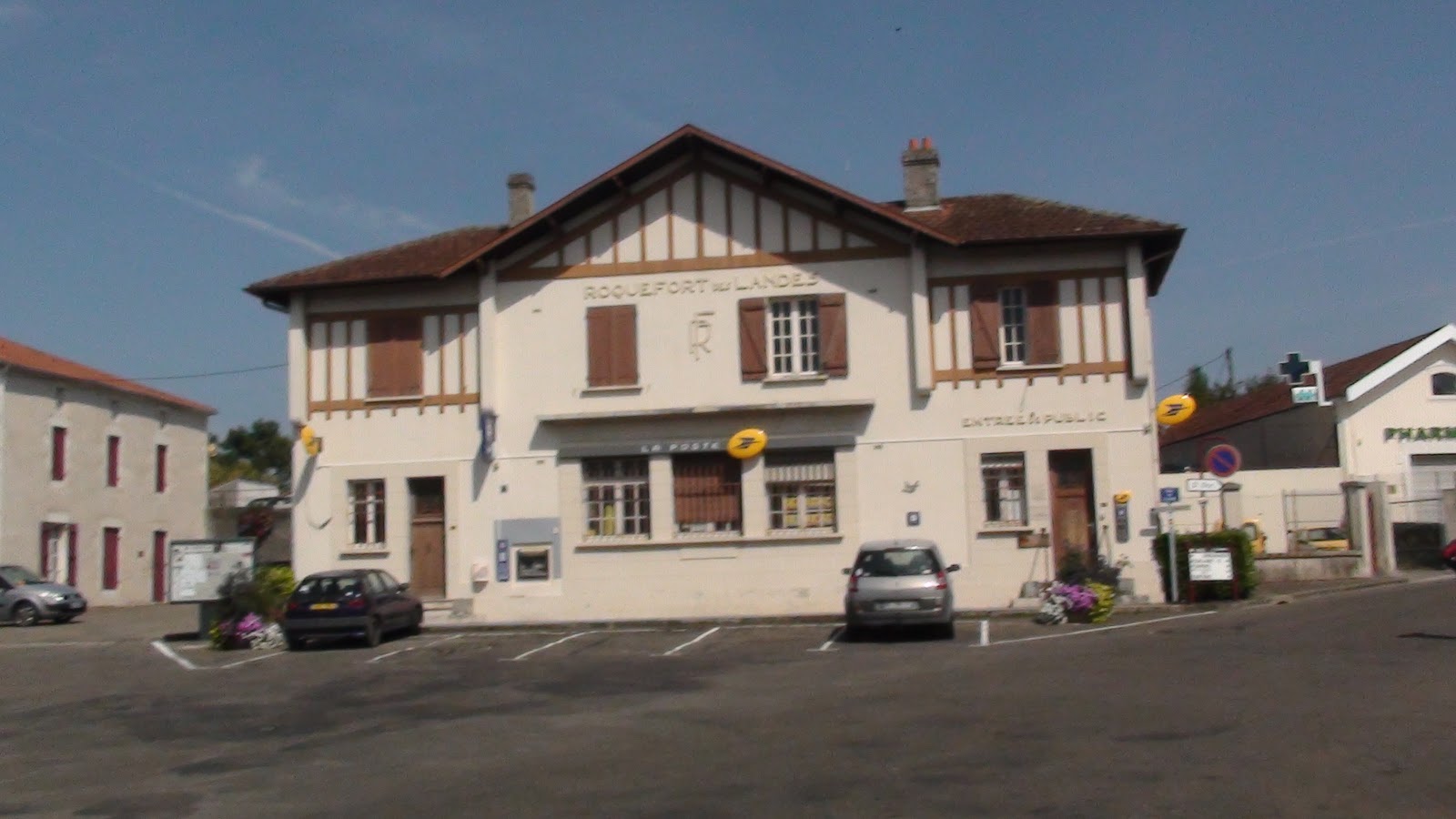
     The whole town seemed asleep or deserted, but near the town center we found a Tabac, a combination tobacco shop/bar that was open, and went in to ask about where to find some good Roquefort cheese to buy.
      To their dismay and my amusement, the owners informed them that we were not in THAT Roquefort, but one of the other three towns in France that are ALL named Roquefort. Consulting the maps, they showed us that the GPS had been taking us to another one of the spurious Roqueforts, and that "le village de fromage" was at least four or five hours drive away from our present location!

      Back in the car again, Bill did a great job of navigating and giving directions from his maps, and we all gave a cheer as we entered the valley of the Dordogne River. An hour later we were pulling into a small public parking lot stretched out along the eastern bank of the Dordogne in the town of Beynac, which lies crowded along the shoreline of the river and clings to precipitous rocky slopes slanted up to the Chateau de Beynac at the highest point above the town.

      One cobblestone street climbs up through the village toward the castle. Narrower, steeper streets suitable only for pedestrians branch off in different directions, leading to large stone houses and small cottages built on seemingly impossible slopes.
      We have a lovely room with a floor to ceiling window that opens onto a french balcony, which is really not a balcony at all, but merely a railing across the lower part of the window to keep the incautious from falling to the street below. This will be our home for the coming week. Tomorrow we'll visit a country market day about 10 km down the river.

Thursday, September 15, 2011

Friday, Day Four

Friday, September 9th
        This morning we walked a few hundred meters to Carrefour, a very large shopping center, where we found a nice patisserie. We each ordered cafe au lait, and small baguette with butter and jam. A perfect light breakfast for a couple of Euros.
      This morning we loaded two cars full of people for the day's adventure to Biarritz on the west coast of France near the Spanish border. It's a 116 km trip, and during most of the hour and a half it took we could see the impressively jagged peaks of the Pyrenees off in the distance to our left.

      We followed instructions to the main train station and waited a short while to be joined by Helen, a young woman from Richmond, Virginia who came to Biarritz for World Vision to start an outreach program for young people. She has been here for some time, and plans to stay, since she met and married Phillipe, a French civil engineer.
      We followed her pumpkin-orange little Renault through the winding streets and around many traffic circles, descending eventually past large elegant homes to a narrow road that skirts the ocean along the bottom of a steep cliff. There is a sea wall along the waterfront here, reinforced with a wide rip-rap of large black boulders. Just beyond the rocks that protect the shoreline there is a sandy bottom that probably forms a narrow beach when the tide is low.
      Large, long swells, perhaps three meters from trough to crest came rolling in from the Bay of Biscay, which is merely a slight curve to the western coast of France, really just the Atlantic Ocean. Hundreds of surfers could be seen sitting on their boards, floating up and over each passing swell, waiting for the perfect wave. When it was perceived that an approaching wave had just the right slope and height, surfers would swing around, belly-flop on their boards, paddling as fast as they could with their hands. Those who had timed it just right would be propelled forward down the slope of the wave, and with a quick grab and lurch would leap to their feet, suddenly transformed into darting, swooping dancers on the curling waves.

      Appropriately, the place where Helen took us for lunch was "Les Surfers". We all sat at one long table facing the water. The wall closest to the seawall was open to the breezes so we could see the surfers, the waves, and the ocean beyond as we ate lunch.
      Jane and I shared Merlu, a plate for two. The English name for this fish is hake. It was both ugly and delicious, the body split into two attached gently broiled fillets drenched in garlic butter and judiciously sprinkled with herbs just behind the dark head with its gray eyes and gaping sharp-toothed mouth.

      After lunch Helen and Philippe led the four-car caravan on a wandering tour of Biarritz, past the casinos and cliff-top mansions, along steep curving cobblestone streets lined with shops offering overpriced elegant goods for wealthy customers, down along the waterfront with small beaches nestled in rocky coves, and up again through more modest neighborhoods. We stopped for a short visit at their new church, a small rented space in a building shared with a surfers' hostel.

      An almost-full moon rose above the low hills in front of us as we headed back toward our hotel after a long day. Tomorrow is a travel day from Lescar east to Beynac in the valley of the Dordogne.

Friday, September 9, 2011

Thursday, Day Three

Thursday, September 8
      It's dark, and Jane is up and moving about, making too much noise for the middle of the night. I think it's 1:00 am. It IS 1:00 am in Virginia, but it's 7:00 in the morning here in France, and it's dark because the curtains are keeping out the bright sunshine. I stumble out of bed and into some clean clothes, and we head down to the hotel lobby for a continental breakfast of Croissants, cafe au lait, fresh kiwi fruit, orange juice. Price is 7 euros, almost $10.
      At 8:30 we meet Robert and several others. We'll all ride together today on a trip to Bilbao, Spain.
      This time we stay on track for awhile. We pause from time to time to take toll road tickets or to insert them in toll booth slots and feed Euros into the slot that raises the gate to let us proceed. Since the formation of the European Union, there is no indication of any demarcation between France and Spain, no official border-crossing, no checking of passports, nothing. I'm not sure when we actually left France and entered Spain, but I do notice that all of a sudden all of the signs are in Spanish. Displayed with the Spanish language signs are additional rows of letters that are obviously yet another language, but I don't recognize it at all. It wasn't until later in the day that I learned that more than 600,000 people in north-western Spain and south-western France speak Euskara (yoush-KAR-ah), an ancient, isolated language that is believed to have been spoken in this region since long before the Roman invasions that started in 58 B.C. It doesn't seem to be related to any other known language in the world.
      As we approach the coast of the Bay of Biscay and the town of Orio, we exit to try to find restroom facilities. A narrow road winds first along a grassy ridge where we see several groups of hikers with backpacks, and a number of cyclists challenging the steep slopes.
      The road dips down between old two story houses. The smooth pavement disappears, replaced by cobblestones, and the street into the oldest part of this old fishing village becomes every steeper and narrower until poor Robert is forced to slow to a crawl, inching between walls that threaten to scrape the car on both sides. Everyone holds their breath as he inches around a very tight corner, hoping we don't get to a point where we can go no farther. It's certainly impossible at this point to back up!
      The steep slope lessens a bit and the street widens a bit as we approach the flat bottom of the valley next to the River Oria and enter the newer part of town. We move along a shop-lined street that appears to be only a few hundred year old, then come to several blocks of new apartment buildings. Robert pulls off on a blind side street, and several people scurry off toward the town center a block away to try to find restroom facilities. They later report that the owner of a small shop, not open, has allowed them access to the single toilet in his establishment.
      Taking a short walk while the others are away, I find an extended area close to the river where there are numerous small farming plots. I don't know if they are community plots or individually owned. I watch an old lady plucking fruit from the low lying branches of a fig tree near the dirt path. 
     Turning back toward the car, walking along a side street, I found a poster advertising the upcoming rowing races. Each boat appears to have 15 or 20 men manning the oars. I am amazed at the similarity of these Basque long boats in the picture to the fautasi longboats that are raced on the bay at Pago Pago, Samoa.
      In our attempt to get back on the highway to Bilbao we missed a turn somewhere, and spend perhaps 30 minutes wandering small, wooded, winding roads that lead us in a loop back into the lower part of Orio before we finally are able to proceed toward our destination.
      Robert has no clear idea of the exact location of the ultra-modern Guggenheim Museum in Bilbao, so we get an extended rambling tour of various parts of this city of more than 350,000. Eventually though, we begin to spot signs to the museum, and find space in an underground lot to park the car about a half mile from the museum.
      The strange, random metallic curves of the Frank Gehry designed building on the banks of the Nervion River catch the late morning sun and also cast dramatic shadows to create a really fascinating piece of architecture. I had convinced myself ahead of time that I would dislike it, but was surprised that it was so intriguing.
     The members of the group wandered off in different directions, promising to meet back at the entrance to the parking garage no later than 4 pm. Jane and I strolled along the riverside and past the museum to view it from different sides, and settled to eat a light lunch of baguettes with thin-sliced ham and pieces of a delicious cheese at an outdoor cafe before heading into the Guggenheim.
      There were vast exhibit rooms with large abstract pieces of art and paintings that Sydney and Francis Lewis would have loved for their peculiarity. 
     I found that the building itself was the only really interesting piece of art, but that alone was worth the trip to Bilbao!

Wednesday ... Day Two

Wednesday, September 7th
      Early indeed!....a few minutes after 11:00 pm the background roar of the turbines slides down to a whisper, and I can feel the subtle change as we sink down into the inky atmosphere.
      The clouds break for a few minutes, and glowing tendrils of town lights and shining arteries of highways create a random web of yellow on the ground far below before the clouds close in again and the window fades to black except for the pulsing red and strobe-flash white of the plane's own lights.
      The flughaven Frankfurt Main is huge, and the plane taxis for almost ten minutes before reaching the gate as the sky begins to turn light about 6 am. The electric cart that has been arranged for Bill seems to be full of other passengers, so he sits in a wheel chair and I stride along behind the cart pushing him, leaving Jane and Miriam to trail behind us, finding their own way down the long labyrinth of intersecting concourses to Gate A-5.
There is just enough time to take advantage of a free double-shot of espresso laced with plenty of cream and sugar before we are called to board the bus that will take us to the smaller plane that will provide our last hop today. By 7:00 am we are bouncing along through the clear sunny air on the 90 minute flight to Toulouse, France.
      It was still early morning when we completed the paperwork to get our four-door Peugeot for the drive from Tolouse to the city of Pau where we are planning to stay until Saturday. I was given the keys, and walked out ot the parking lot to get the car. It had two doors! Back to the check out counter, where I was told that I had to go all the way back to the car rental counter in the airport terminal to get the error corrected. they had no four door cars in the class we had reserved so we go an upgrade that wold have cost a couple of hundred dollars more. It was worth the trouble.
      Robert, the tour agent suggested that we follow him out of the airport to the main highway. It soon became apparent that we were heading north on A62 toward Montauban instead of west toward Pau. I sped up, came alongside him and rolled down the window to call out, "Where are we going?"
      His shouted reply was, "I have no idea where I'm going!"
      I called back that we were bailing out. We got off at the small town of Grenade, and instead of turning around and going back to the start point, Bill and I agreed to use the maps we had and find country roads that led us in the general direction we wanted to go. We spent a delightful morning wandering across the French countryside to Cadour, Cologne, and other very small villages. 
     We crossed the Garonne River on an old arched stone bridge and made our way down to L'isle de Jourdaine, where we took theN214 to the city of Auch, and then the N21 to Tarbes, where we got our first distant views of the jagged peaks of the Pyrenees. The A64 is a smooth four lane divided highway toll road where the speed limit is a bit over 80 mph. Like Interstate highways in the U.S. though, many drivers go faster than the speed limit. We picked up a ticket at an automated tool booth and sailed on west toward Pau. 
     When it came time to exit just beyond Pau we couldn't find the toll ticket! We pulled into the automated tollbooth, and hailed an attendant. We were afraid that we would have to pay the maximum fee for traveling from the beginning to the end of the toll road, but the courteous, trusting lady that we talked to believed our story, and only charged us for the section of the road that we had traveled. In spite of printed instructions, se had to stop and ask for directions to the Novotel just beyond Pau in Lescar. After unpacking, several of our group met for an elegant twilight dinner on the terrace at at the hotel.

Wednesday, September 7, 2011

Doing Dordogne, Day one

Tuesday, September 6
It rained all night the day I left....
     A last minute morning check of the weather shows that Hurricane Katia is veering offshore and will not make landfall while we are on our trip to France...relief!
Our first flight of the day from Richmond to Philadelphia is scheduled for departure at 1:15 pm. Bill and Miriam and Harry arrive in our driveway promptly at 9:30, and we're off to the airport. We unload the luggage at US Air and use the automated check-in kiosk which scans the data on the edge of the passport page to identify and confirm each passenger and print boarding passes. With a chunk and a whirr the machine spits out two boarding passes for each of us, from Richmond to Philadelphia and Philadelphia to Frankfurt, Germany. The boarding pass for the leg from Frankfurt to Toulouse, France doesn't appear.
      When we ask the airline representative behind the desk about that she says that normally we would get that at the Frankfurt airport, but that she can issue those boarding passes from her desk if we'd like. We'd like! I hand her the passports, and after a moment of looking at them she says, "If you'd like I can get you on the flight to Philadelphia an hour earlier at 12:16 pm. The weather in New York is beginning to cause delays, and it's my experience that backup often begin to effect the traffic at Philadelphia.
      I immediately think it is a good idea, but we are traveling as a group of twelve people, and when I broach the subject, others show considerable agitation and aversion to any change of the plans. The airline rep manages to get the other group members who have already checked in together and explain the advantages of taking an earlier flight to the gateway city for overseas flights, and finally consensus is reached; we'll take the earlier flight. However, within minutes, the rep is back, saying that the dispatcher in Charlotte, NC is telling her that the earlier flight has some minor mechanical problems to be resolved and will be about a half hour late.
      OK, so we now are scheduled to leave a half hour before our original plans, and that still seems to be an advantage. We all get booked in, receive our modified boarding passes, and head for the gate.
     The flight arrives and the Charlotte passengers get off and go streaming down the concourse toward the luggage claim area. The time for boarding comes, and we hear an announcement on the speakers saying that although the plane is ready to go, there are now no planes landing in Philadelphia due to very heavy rainstorms directly over the airport. Please stand by.
      After some considerable time has passed, boarding is announced, and we all make our way down the enclosed ramp to the plane and slowly down the aisles to our seats. The pilot announces on the address system that as soon as he receives clearance from the dispatcher in Philadelphia we'll be on our way. Eventually the doors are closed, the plane is rolled back and taxied to the end of the runway. The pilot pushes the throttles forward, the engines roar, we feel the acceleration as the planes plunges down the runway, and the wheels leave the ground as the plane surges into the air at 2:00 pm, forty-five minutes later than the original scheduled flight.
      A few hundred feet above the ground the view out the window quickly fades to a uniform light gray as we climb into the thick cloud layer hanging low over Richmond, and the world disappears. screen. Thin, dark rivulets of water race sideways across the window, giving it the appearance of a malfunctioning LCD screen. The plane lurches and sways its way upward through various air densities and currents for fifteen minutes before the gray begins to lighten as we approach 27,000 feet. We break out of the top of the cloud layer and look down briefly on the misty, soft, sunlit cloud bank below. Soon we enter the cloud layer again, the aircraft doing its best to simulate the rocking, pitching yawing motions of some long-ago stagecoach as we travel our aerial highway to Philadelphia.
      In spite of the switches and delays, we arrive a bit more than an hour before the scheduled departure of our flight to Frankfurt. All is well. We'll wake up tomorrow morning (early) descending to land in Germany.

Friday, September 2, 2011

The Lizard, Mount St. Michaels, and Land's End


Sunday, May 22

It rained during the night, but by breakfast time the clouds were clearing, and by 9:30 we looked out on a bright, windy, chilly, but sunshiny day. We drove along the A-30 highway, hunting The Lizard. The southernmost cape of land in England is called, for some mysterious reason, "The Lizard". It is most probably a corruption of the Cornish name "Lys Ardh", meaning "high court". 
 

A short walk to the point meanders along high, jagged, almost vertical cliffs that drop about 200 feet to jagged rocks awash in the rolling breakers. Fat, succulent three-cornered leaves of iceplant cradle scattered large pale yellow flowers, and ragged carpets of brilliant magenta flowers cascade down the steep slopes as if a mad artist had flung buckets of day-glo paint over the edges of the cliffs.

      A wide cobblestone path too steep to be called a road curves down sharply to a rocky spot at sea level where brave souls can launch small boats across surging mats of slippery seaweed to make their way through breaking surf between jagged rocks to open water.

      Heading almost due north, we backtracked 10 miles to the town of Helston. Ten miles west brought us to Marazion and a long line of vehicles creeping through the narrow streets of town competing for parking places. After our own unsuccessful reconnaissance we paid the five-pound fee to squeeze into an already jammed parking lot next to the sea wall. A very broad, flat beach sloped gently to the white-capped waters of Mount's Bay where wind surfers and kite boarders swooped across the surface at unbelievable speeds. We joined the general drift of hundreds of other people along the hard sands in the opposite direction, toward the lumpy cobblestone causeway that curved out, barely a foot above water to Saint Michael's Mount a quarter of a mile from the shore.


      Saint Michael's Mount, like its larger Normandy namesake Mont Saint Michele, is a triangular mini-mountain that juts up several hundred feet not far from the shore of a very shallow bay where low tides retreat far from the shore, but come rushing in as high tide approaches, turning them into islands.

      Saint Michael's Mount was the site of an abbey as early as the eighth century, and was given to the Benedictines of the Norman abbey of Mont Saint Michel in the 1200's which seems to be how it got its name. The old Cornish name for the place was Karrek Loos y'n Koos meaning "grey rock in the woods". It may have been exactly that, for in November of 1099 it is recorded that a huge storm swept the ocean far inland. The backwash may have carried away the woods and the land, leaving only the solid grey rock outcropping remaining close to the new shoreline.

      The small walled harbor of Saint Michael's Mount faces away from the sea. As we reached the island end of the causeway and entered the gate to the town we could see a number of boats tilted to the right or tilted to the left, their hulls resting on the sandy bottom of the drained harbor. If we stayed too long the boats, re-floated, would be our only way back to the mainland, since at high tide the causeway is completely submerged. 
 

      There was a music festival going on, and we stopped several times on the steep climb up the rough cobblestone path to the castle to listen to different groups. A group of Morris dancers was performing on the roof of the castle itself.

Although part of the castle is under the administration of the National Trust and is open to the public, the island and the castle have been owned by the same family since 1659 when it was sold to Colonel John St. Aubyn. His descendants are still resident on five private floors of the castle.

      We found our way back across the causeway long before the incoming tide, navigated our way out of the crowded car park, and turning left, headed toward the town of Penzance.


      The harbor there, like the beach at Marazion slopes very gently toward the sea. All of the water drains out of the basin at low tide, leaving all the moored boats sitting on the mud. Consequently many of the boats have two keels, one on each side instead of a single keel, providing a solid two-legged base when the tide is out. Other boats are simply propped up each side of the boat with sticks. Those that have neither simply tip over as the tide goes out.

      Navigating toward Lands End without consulting a map, by keeping the ocean on my left and selecting roads that ran close to the shore, I next found my way to the delightful village of Mousehole. 
It was aptly named, for the twisting, steep streets between the crowding houses were so narrow that at times there were only inches to spare on both sides of the car, making me feel as if I were climbing through a mouse's burrow. When I mentioned to the barman at the inn where we stayed on Sunday night that we'd driven through Mousehole he looked puzzled for a few seconds and then said, "Oh! You mean MOE-zul!". That made me think of the tale our friends have enjoyed telling about their travels in England many years ago. They were looking for a town with the very French spelling of Beaulieu, and asked for directions, using the French pronunciation bo-leeYUH. After some confusion on the part of the listeners, the reply was, "Oh! You must mean BYOO-lee!"

      Leaving Mousehole behind did not mean that the roads suddenly got wider. As I hugged the right side of the road close enough that leaves and stems and the blossoms of small wildflowers tickled that side of the car I could also hear the other side of the car being caressed gently from that side as well. Not as romantic an image as one might think, for directly behind the encroaching greenery was the solid Cornish stone of five foot high walls.


      A lucky missed turn brought us along a similar road etched into the side of a steep wooded hill to Lamorna Cove where the few stone houses seemed to blend into the stoney background of rocks surrounding the tiny harbor.
       I backtracked, took another turn, and found that the pavement had disappeared, to be replaced with gravel tracks separated with a green high crown down the middle. It seemed to be going in the right direction, so I followed it between the clutching green walls that were beginning to crowd even closer until the point where even the gravel faded away beneath the green overgrowth. Although I could see that the now almost invisible track pointed toward the tops of chimneys only a few hundred yards away, I was concerned that I would actually scratch the sides of the brand-new rental car or get stuck. I backed to the last place wide enough and turned around.

      Now on a paved road that was at least wide enough for one and a half cars, it seemed like a proper highway, although it was still narrow enough that meeting a car traveling the opposite direction would be occasion for one or the other backing up until a wider passing spot was found.

      I had seen on the map a very tiny, barely noticeable symbol that designated a prehistoric site. Several cars by the side of the road indicated to me that there was something of interest, and on investigation I found a small stone marker labeled "The Merry Maidens". That sounded promising! I inserted, rather than parked the car in the tiny bit of space remaining, and climbing over a stone stile, we walked up a path across a meadow where long grass rippled in the strong wind like waves on a stormy sea. 
 

      Less than three hundred yards from the road we found a circle of ancient standing stones. Each of the nineteen stones had rough edges, hewn in prehistoric times into blocks perhaps two and a half feet wide and about a foot thick. I couldn't tell the length, since the blocks that must have weighed a couple of tons each had been transported to this site and then tipped up into holes that were filled in to hold them upright. Each was about twelve feet from its neighboring stones on either side, all of them arranged into a perfect circle. Nobody knows who erected this arrangement of stones nor when, though it had to have been several thousand years ago.

      The headland at Land's End has all the dubious charm of Myrtle Beach, North Carolina or Gatlinburg, Tennessee with arcades, 3D movie screens, trinket-filled shops, and a slightly seedy-looking hotel. Land's End for those interested in geology and geography is more interesting. 

The westernmost point of land in Great Britain, its dark rocky cliffs and jagged dark outcroppings farther out plunge down into white waves crashing in from the Atlantic Ocean. A quarter mile offshore the Land's End Lighthouse clutches the outermost black rocky reef and flashes a warning to heavy laden ships plowing west and east though big seas that once in awhile send tons of water splashing over their bows.

It was quite late in the afternoon by the time we left Land's End and headed back up the peninsula. We stopped to inquire at several bed and breakfast guest houses before we were successful at finding a place to stay for the night in the village of Lelant near St. Ives. 
We settled in to the Badger Inn and pub for dinner just after sunset a little before 9:00 pm, and then made our way upstairs for a good last night's sleep in Cornwall before starting the long drive back across southern England to Gatwick and the flight home.

Thursday, September 1, 2011

An old Seaport and Another Planet


Saturday, May 21
After a leisurely breakfast we left Par to visit an outpost on another planet. At least that's what it seemed like. The Eden Project, an enormous research/educational undertaking has constructed two three-lobed biodomes in an old abandoned china clay quarry. 
Thousands of tons of rich soil have been spread on the slopes and terraces, and the scars of excavation have disappeared under inspired landscaping. Hundreds of twenty-foot-wide six-sided plastic panels have been formed into huge bubbles a hundred and fifty feet high, each enclosing a separate ecosystem. One holds the warm, humid atmosphere of a tropical rain forest, with thousands of plants from all over the world growing in wild profusion. The second dome incorporates plants from all over the world that thrive in a Mediterranean climate. The two domes, set in their sunken garden of plants that now fill the old quarry are evocative of a futuristic science-fiction city built on some distant hostile planet.
In the afternoon we drove to the little coastal village of Charlestown, a single cobblestone street plunging down to the tiny harbor. There were fewer than a hundred houses, built of stone, and at least three pubs. Halfway down the hill the street split left and right, one going down one side of the harbor and one down the other. The harbor itself is a bit less than thirty yards wide and perhaps a hundred yards long, with vertical stone walls that drop fifty feet to the surface of the upper harbor. There is also a lower harbor, separated from the upper by a sea gate that can be opened at high tide, and closed so that the water level in the upper harbor doesn't go down when the tide goes out, dropping the sea level in the lower harbor by almost fifteen feet. The lower harbor, itself not much wider than fifty yards, is almost completely surrounded by a thirty foot high sea wall, curving around until there is only a small opening where boats can exit parallel to the shingle beach, dodging the half submerged stone barrier to the port side while swinging to starboard as quickly as possible to head into the waves that come heaving in from open water. Getting either in or out of this tiny walled sheltering harbor in anything but the calmest of weather must have tested the skill and bravery of those steering the ships.
Although almost deserted today, there was a time when ten or fifteen tall masted steamer/sailing ships would crowd in at the same time, rail to rail, waiting to be loaded with the high grade Cornwall clay that was shipped to makers of fine china and porcelain.
A short drive on good roads brought us finally to the town of Truro. Tomorrow is the music festival at Mount Saint Michael.

Bristol and Par


Friday, May 20
We ate a late breakfast in the hotel dining room, overlooking the turning mill wheel, and then packed our things back in the car for the drive to Bristol in time to eat lunch with the Cunningham-Burleys. Before heading on down the M-4 Motorway Exeter and Cornwall we went to visit their church to see the stained glass window they did.
We stayed that night in the town of Par at the Royal Inn, which was not so royal, but pleasant enough, with good food and a nice, almost empty pub where we drank a pint after dinner . 
We watched as people began to drift in, filling the place to crowded by 9:00 pm, coming mainly for drink and discourse, but also to listen to a local band that was loud and enthusiastic and actually pretty good. By the end of the first set the place was jammed, and we were ready to retire to the other wing of the building. Upstairs, it was quiet, and we slept easily.

A ride on the Avon and a Visit to Bath

Thursday, May 19
      Our last morning in Sussex. After a nice breakfast and good-byes, Hugh drove us back to the Gatwick airport to pick up a rental car. We negotiated the roundabouts and straight stretches of the M23, M25, & M4 Highways, comparable to interstate highways in the U.S of the three and a half hour drive west to the town of Batheaston. After cruising the main road through town twice we had to stop for directions to the Old Mill Hotel on the edge of the Avon River.


     Our room on first floor overlooked a private toll bridge and weir spanning the river that impounded water for the mill. The mill wheel still turns, but is no longer used for milling. Looking across the river about a hundred yards we could see a second mill on the opposite side of the bridge, and next to that, a floating pier where a ferry boat docks. From here it is only about three miles by ferry boat down the Avon to the town of Bath. We waited about an hour for the next ferry, really more of a motor-launch, and enjoyed the leisurely cruise down the river. 


    As we approached the town we passed under the main bridge across the river, one of only three in the world that has shops built on both sides of the bridge itself. The weir just downstream of the bridge is shaped like a deep, extended letter U, allowing at least three times the volume of water to flow over during flood stage as a straight-across weir.
The ferry tied up at a wall on the edge of the river, and we hopped off to explore the streets of town. A short walk brought us to the famous Roman baths after which the town is named, and Bath Abbey. 
 
      The hot springs were known to Iron Age Britons, who believed the springs inhabited by the Goddess Sulis, and the conquering Romans starting about AD 43 built elaborate baths and a temple dedicated to Minerva, whom they equated with Sulis, naming the town Aquae Sulis ("the waters of Sulis") The temple was constructed in 60–70 AD and the bathing complex was gradually built up over the next 300 years. 

     During the Roman occupation of Britain engineers drove oak piles into the mud to provide a stable foundation and surrounded the spring with an irregular stone chamber lined with lead. In the 2nd century, the spring was enclosed within a wooden barrel-vaulted building, which housed the calidarium (hot bath), the tepidarium (warm bath), and frigidarium (cold bath). It was fascinating to wander through the different rooms and imagine what they must have been like so long ago.
      Exiting the roman baths we walked back a few blocks toward the ferry landing, hurrying toward the bus stop as the bus to Batheaston came down the street less than half a block away. We waved to get the driver's attention. Looking directly at us, but pretending he didn't see, he drove off. The next bus came along in 25 minutes. As it approached, other people came running down the block as the bus started to pull out, but this driver stopped and waited. Batheaston was only a short ride. We got off in the middle of the village. 
     A short walk along the narrow main street brought us to the Waggon and Horses Pub, where we stopped for a bite to eat. Seated at the at next table was couple from Edmonton, Alberta who were carrying everything the needed in small backpacks, planning their travel itinerary day by day, and traveling by public bus from town to town.
    Tomorrow, we'll take a leisurely drive to visit friends in Bristol.

Wednesday, July 6, 2011

Sheffield Gardens and Giants

Wednesday, May 18
     Sheffield Park Gardens is one of many parks held by the National Trust, similar to National Parks in the United States. Originally the gardens were part of the Sheffield estate. Today the manor house at the edge of the gardens is still privately owned, but the grounds have been conveyed to and are maintained by the National Trust. They are open for the public to enjoy. The extensive gardens include an incredible variety of plantings that include hundreds and hundreds of rhododendrons of all shades growing in clusters twenty to thirty feet tall along the banks of four lakes. I was startled to discover giant redwood trees! Here is a fascinating connection between the Sheffield Park Gardens and Calaveras County in California.
     In 1853, William Lobb, a salaried "plant hunter" for the Veitch Nurseries in England, was in San Francisco, California, attending a meeting of the newly formed California Academy of Sciences when the Academy’s founder, Dr. Albert Kellogg, introduced a woodsman who had been hunting in the southern Sierra Nevada mountains for game to supply a canal-digging crew. He had shot and wounded a grizzly bear, and while tracking it had discovered a grove of trees that were enormous beyond all belief. The hunter was astounded, and abandoning his pursuit of the bear hurried back to camp with his tale, where he was derided and even accused of drunkenness when he recounted his experience in the forest of giant trees. Luckily the scientific community proved more liberal-minded, and the crowd at the California Academy of Sciences greeted the specimen produced by Dr. Kellogg with excitement.
     The amazing story filled Lobb with the determination to see the remarkable trees in their native habitat, but his hurried flight to the Sierra foothills was largely fueled by thoughts of riches. He knew these "monster trees" would trigger an equally enormous craze in British horticultural circles, and he was determined to provide the owners of the Veitch Nurseries with the plant material needed to corner the market.
     Reaching the grove in Calaveras County, he collected seed, shoots, and seedlings. In fewer than two years’ time these would give rise to thousands of saplings, snatched up by wealthy Victorians to adorn great British estates. The larger-than-life conifer, so symbolic of the vast American wilderness, suddenly became a status symbol, rising boldly from expensive and highly groomed landscapes an ocean away.
In England it was proposed to name the newly discovered species "Wellingtonia" in honor of the Duke of Wellington who had died recently. The name was rejected however, when it was determined that there already was a completely unrelated plant that already had that name, and the botanical name of Sequoiadendron Gigantea was assigned to acknowledge the biological connection to the coast redwood, Sequoia Sempervirens. In England, however, these giant redwoods are still referred to as "Wellingtonia", and the specimens in Sheffield Park Gardens, more than 150 years old now have massive trunks almost 40 feet in circumference.
     We ate dinner at the Mark Cross Inn in the village of Mark Cross, Crowborough before calling it a full day and heading back to Heathfield.